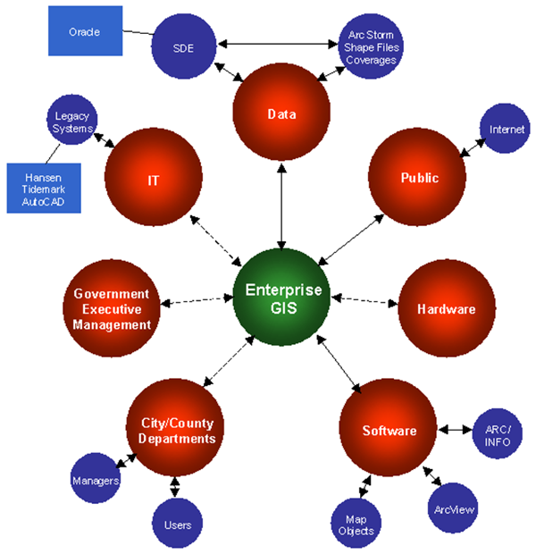
As GIS problems become larger and require more data, personnel, software, and hardware, we move into the realm of enterprises. An enterprise is beyond one person and typically includes multiple organizations.
Enterprise GIS (Esri)
Enterprise GIS allows us to exchange information and present spatial data in more effective ways than before. This includes:
The complexity of enterprise-level GIS requires using the Internet to connect everyone involved and needs special software and, at times, hardware.
Enterprise GIS builds on existing desktop computers (workstations) and traditional GIS software. To this is added:
© Copyright 2018 HSU - All rights reserved.